How to scan the underside of a structure
Published: Updated:
In order for Skydio to capture the underside of a structure, such as a bridge or an interior roof, you must enable the Upward Capture toggle located in the scan settings.
Skydio will automatically move the camera Gimbal pitch to look up when it detects the height of the drone is below the specified scan Surface.
[info] 2D Upward Capture is compatible with geofencing as well as when scanning in indoor or GPS-denied environments. [/info]
Best practices and recommendations
| Enable Stop for Photo when scanning the underside of a structure in low-lit environments. | |
| When scanning narrow bridges, set pillars underneath or at the edge of the bridge. Doing so will help the drone relocalize during multi-battery scans. | |
| When scanning homogenous surfaces, such as solid steel or concrete structures, we recommend increasing your Distance to Surface (about 16 ft / 5 m). Scanning too close to such structures may result in difficulties when creating a reconstruction. | |
| The height below the Surface will be equal to the difference between the Surface height and scan height. | |
| For added clarity, you may still pilot the drone below the Surface and utilize the Set Height to Current function. | |
| For Skydio X2 Color/Thermal users, we highly recommend a Distance to Surface of about 32 ft (10 m) |
[caution] If you are flying with a Skydio X2 Color/Thermal camera, please note that pointing a thermal camera into direct sunlight may cause permanent damage to the sensor. [/caution]
Bridge use case example
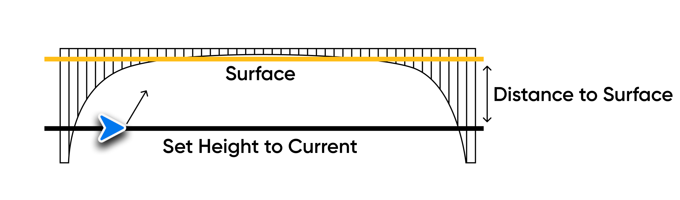
The example image above shows a proper setup to capture the underside of the bridge.
- After setting the scan Surface in this scenario, enable the Upward Capture toggle in scan settings
- The gimbal angle will automatically look up to capture the underside of the bridge
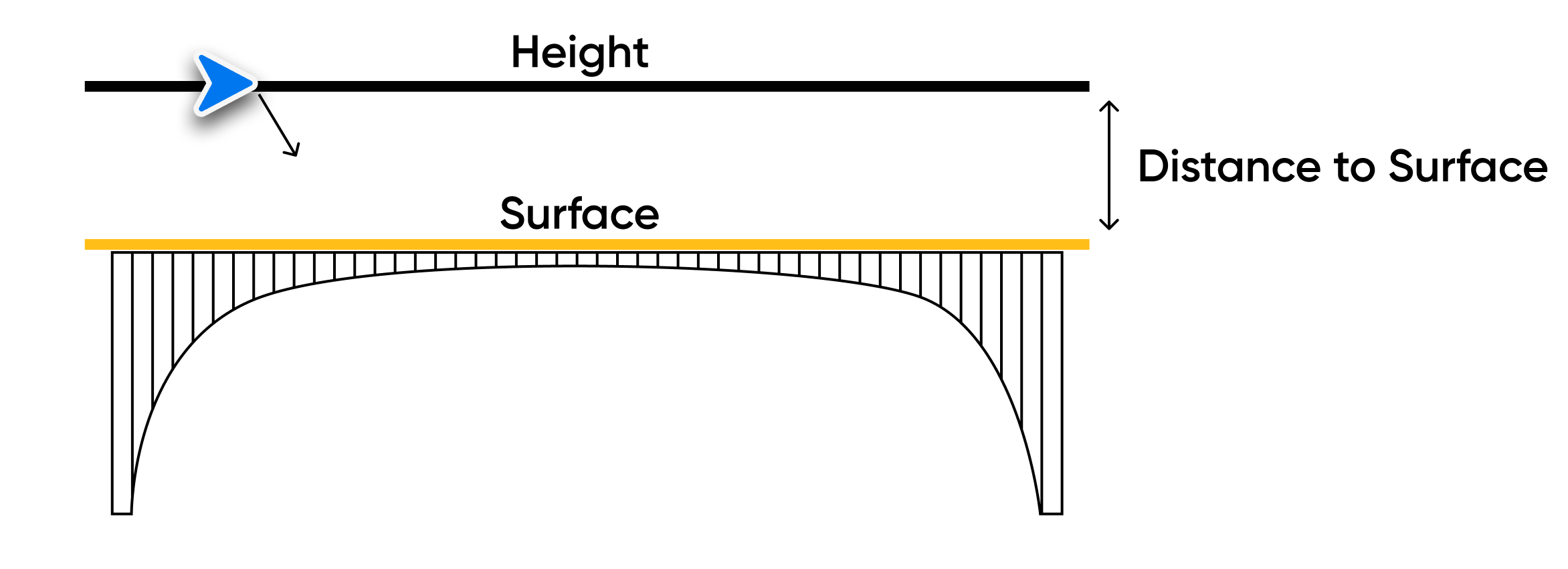
In the example image above, the user has set the Surface to cover the bridge deck, and the altitude of the drone is above the scan Surface.
- In this scenario, the Height can be set one of two ways: using the Height slider or by flying to the desired altitude and selecting Set Height to Current
- The gimbal angle will automatically look down to capture the bridge deck
- Using the Set Height to Current feature is not a requirement when capturing the top of a bridge
Recommendations for DroneDeploy reconstructions
To process a successful 3D model of a 2D Upward Capture, ensure you select Vertical Model:
|
 |
Explore More
Explore related articles for additional information
How to use 2D Capture with 3D Scan
3D Scan Settings Overview
How to create 3D reconstructions
Skydio, Inc. A0285
Was this article helpful?